Telecommunications Geospatial Services
« Return to Project Search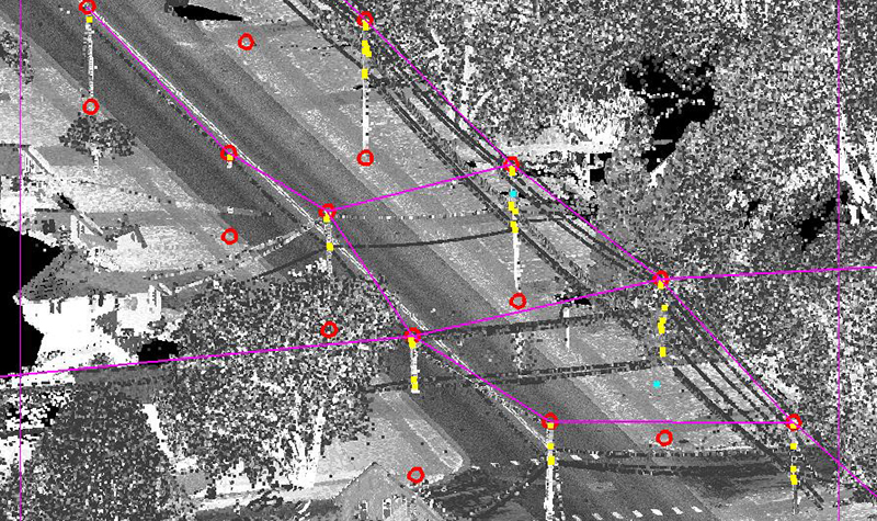
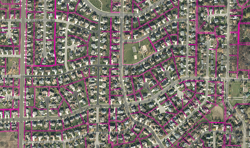

Ayres completed a high-priority, quick-turnaround project for this major phone, Internet, and TV provider. Using geospatial technologies to locate and map existing utility infrastructure within the public right-of-way to support network design, the project covered 180 linear miles in northeastern Dane County, Wisconsin, in November and December 2016.
The technological approach required a complex combination of GIS, remote sensing, and field data collection, including mobile lidar, 3-inch pixel resolution aerial imagery, and ground-based GPS survey. The data was consolidated and processed to extract attachment points on utility poles, edge of pavement, building footprints, and utility strands into an Esri geodatabase format.
Through a combination of geospatial data collection and analytical methodologies, Ayres was able to provide a wide range of utility information in an easily consumable GIS format, all of which was expedited for completion in a six-week period.
Project Information
Client's NameConfidential Client
LocationSun Prairie, WI
Primary ServiceGeospatial
MarketEnergy + Utilities + Tech