Lac Vieux Desert Band Wild Rice Mapping
« Return to Project Search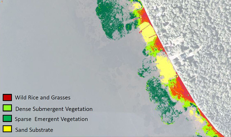
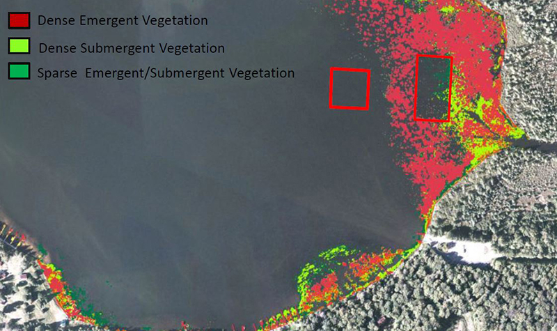

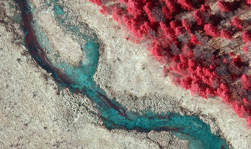
Ayres was retained to process imagery collected with an aerial camera to produce a map of wild rice beds on the Lac Vieux Desert Reservoir in northern Vilas County. The remote sensing imagery was captured during a short window of opportunity in late August 2012, when the rice was at peak maturity. Ayres processed the color and near-infrared imagery to 6-inch orthoimagery for use by the Lac Vieux Desert Band of Lake Superior Chippewa Indians.
Project Information
Client's NameLac Vieux Desert Band of Lake Superior Chippewa Indians of Michigan
LocationVilas County, WI
Primary ServiceGeospatial
MarketState + Federal + Tribal