Colorado State University Impervious Surfaces Mapping
« Return to Project Search
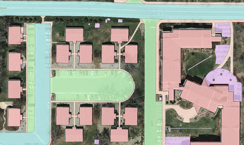
Ayres mapped impervious surfaces on the Colorado State University campus for the City of Fort Collins. The features were compiled from aerial imagery captured in the spring of 2014 to assist with stormwater fee computations.
The work is part of the 2013 Northern Colorado Geospatial Consortium contract through which Ayres provided an array of customized aerial lidar (light detection and ranging) and imagery services in support of floodplain mapping and drainage study services for public and private entities throughout northern Colorado. The consortium includes Larimer County, the Cities of Fort Collins and Loveland, and Colorado State University.
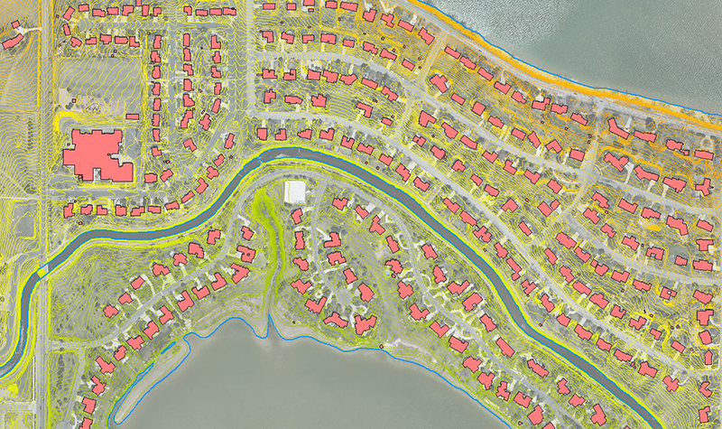
Other work under the contract included photogrammetrically compiling building footprints for the City of Fort Collins’ Growth Management Area. Ayres performed this work from aerial imagery collected in the spring of 2013. The processed stereo-imagery from this aerial mission supported the compilation of planimetric features at a map scale of 1 inch = 50 feet (to National Map Accuracy Standards).
Project Information
Client's NameCity of Fort Collins
LocationFort Collins, CO
Primary ServiceGeospatial
MarketLocal Government