People
Over the years, we’ve been honored to welcome some of the most talented minds in the industry to our team, and our partners benefit from their knowledge, guidance, and expertise.

Jason Krueger
(he/him)
Vice President - Geospatial Services
Madison, WI
608.443.1200
KruegerJ@AyresAssociates.com

"Jason has always been very proactive. He delivers on what Ayres says they're going to deliver in terms of the time and the price."Steve Tilton
Tinley Park, IL


I bring decades of aerial mapping, remote sensing, and GIS experience to my position as vice president of the Geospatial Division, which involves overseeing aerial mapping and surveying operations. I have worked both as a technician and as a project manager on a broad range of mapping and land information services projects completed for clients in the public and private sectors.
My specialties include high accuracy mapping applications for transportation design, utility survey, and municipal public works.
My areas of expertise include:
- Aerial and ground-based lidar
- Aerial imagery
- Photogrammetry
Education
- BS, Geography, University of Wisconsin-Stevens Point
Registrations
- Certified Photogrammetrist, ASPRS, US
- Fly Dane
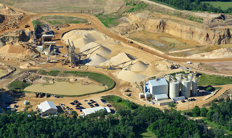
- Preferred Sands General Engineering
- Telecommunications Geospatial Services
- Hennepin & Scott Counties Mapping
- WisDOT Ongoing Geospatial Services
- University of Iowa Flood Protection
- Adams County Landfill UAS
- Whispering Willow Wind Farm
- I-43 Mobile Lidar Survey
- Monroe County Landfill UAS
- Boulder Lidar & Orthoimagery
- Wisconsin Regional Ortho Consortium
- Illinois GIS Consortium
- Kersey Infrastructure Assessment
- Wastewater Force Main Spill Response
- Northern Colorado Geospatial
- USGS 3D Elevation Program
- CSU Impervious Surfaces Mapping
- Libertyville GISC Mapping 2019