Geospatial Technology Evolving But Rooted in Fundamentals

 By Zach Nienow, GISP, and Aaron Sale
Drones. HD scanning. 3D surface modeling. The technological tools of the trade are ever evolving in the geospatial industry. Ever wonder if the basic principles of photogrammetry still matter? They do! And if you ask us, the science behind aerial imagery and photogrammetry is more relevant today than ever.
 Accurate, up-to-date mapping data provides local, state, and federal agencies with the core data they rely on to make important land use planning decisions. Producing reliable datasets from the latest aerial technologies requires a thorough understanding of photogrammetric fundamentals, beginning with orthoimagery – the base reference data used in GIS environments.
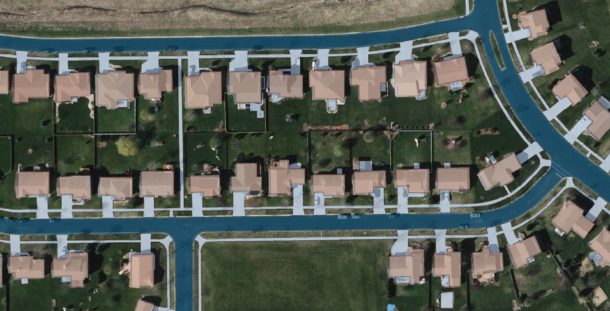
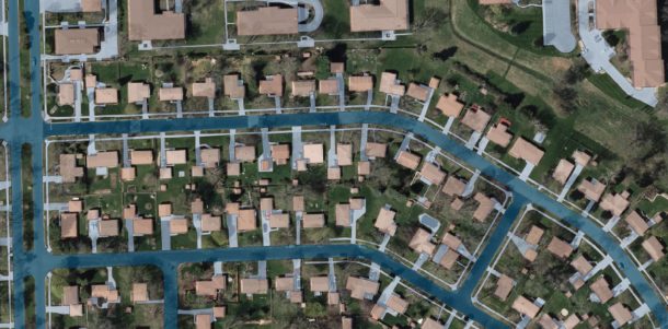
Digital orthoimagery blends the geometric and spatial characteristics of a map with the visual qualities of a digital photograph and serves as the foundation from which base maps are created. Which begs the question: Do you know the critical components that go into creating an orthoimage?
Let’s begin with the basics of ortho production, starting on the data acquisition side.
1. Digital aerial sensor
Using a metric, mapping-grade camera and the proper sensor for the job is a key piece of the collection process. Did you know that the most accurate part of a digital exposure is the exact center? As you move to the outside of the exposure, you’ll notice slight but definite inaccuracies based on the geometry of the camera lens and inherent geometric distortion of aerial photography. In the ortho processing steps, which we’ll explain later in this blog, we minimize these effects to produce an accurate orthoimage. But it all starts with the sensor.
2. Airborne GPS (ABGPS) and Inertial Measurement Unit (IMU)
Along with a highly accurate metric camera, it’s also important to use tightly coupled airborne GPS and IMU. This in-flight data is used to refine flight line trajectories and orientate images, which streamlines the aerotriangulation process.
3. Ground control
The collection of ground control points is critical data for the production of orthoimagery to meet stringent accuracy standards. Ground control is also required to independently assess the horizontal accuracy of the final datasets.
That leads us to the ortho processing phase and another series of equally important components.
4. Aerotriangulation (AT)
A tightly coupled AT solution allows you to take a collection of images and accurately bundle them into a single block. The ground control is then brought in to the AT solution to further increase the accuracy to a known spatial reference system.
5. Orthorectification
During this important step, the AT solution is applied, and a digital terrain model (DTM) of the earth’s surface is introduced to the imagery block. The resulting images are transformed to the underlying terrain and now have the spatial qualities of a map.
6. Image mosaicking
To achieve consistent image quality and accuracy across the project area and to address the overlap between tiles, it’s important to “mosaic” the images. In this step, we carefully select portions of the overlapping images to create a seamless mosaic from the individual rectified images. Throughout this process, the color, tone, and contrast of the images are taken into account and adjusted to achieve consistent aesthetics.
7. Image editing
In this phase we go through and inspect every tile/image for anomalies that were caused by the underlying digital elevation model or mosaicking process. We also conduct stringent quality control (QC) procedures on all of our ortho image tiles to ensure quality.
8. Customized delivery
Following the editing and QC, there’s custom tiling and mosaicking to create deliverables in native resolution and compressed formats to best balance file size and image quality tailored to the project. Lastly, custom coordinate reference system, datum, and units are applied to meet the project requirements.
9. Metadata production
As the final step, we create metadata to go along with the orthoimagery deliverables to help users understand suitable applications of the data. The metadata includes information about acquisition timeline, sensor, processing steps, stated accuracy, and contact information for the data producer.
We apply these photogrammetric principles in all of our projects – no matter if they’re a small- or large-area imagery project. The process also applies when creating accurate datasets from other aerial platforms, such as oblique systems and UAS (unmanned aerial systems).
 Here’s some final ortho-related food for thought, which involves other factors to consider when analyzing an aerial imagery dataset:
- What is your source imagery? Where did your imagery come from?
- What time of year was it flown? Were leaves on or off? Does it fit your use?
- Were accuracy checks performed? If they were, is the ground control available to verify your stated accuracy?
- Is the imagery produced in the proper coordinate system, datum, and units to meet your project requirements?
- Is quality metadata available, and does it provide you with the information you need?
- Are you using the native resolution imagery, or has it been compressed or resampled?
All are key factors to consider when using aerial imagery products for basemapping purposes.
Want to learn more about the science behind aerial imagery, orthoimagery production, and photogrammetry – and why it matters? We’ll be hosting a free webinar titled “Orthoimagery 101 and the Latest Advancements” from 1 to 2 p.m. on Thursday, May 3. Click here to reserve your seat.
Zach Nienow, GISP, is a geospatial project manager with extensive experience in digital mapping, GIS, and project management. Zach designs and leads lidar and orthoimagery projects from planning through flight and then data processing, quality control, and completion. He serves a diverse range of clients in the private and public sectors, including many counties and municipalities. As program manager for the Wisconsin Regional Orthoimagery Consortium (WROC), Zach is part of a team completing orthoimagery and lidar projects for over 100 members and partners. Orthoimagery has been the foundation of regional mapping efforts in Wisconsin and is the base product coming out of WROC.
Aaron Sale is Ayres’ orthoimagery supervisor. His expertise includes aerial imagery flight planning and acquisition, digital orthophotography, surface generation and editing, and process implementation and improvement. Aaron has led imagery development for major orthoimagery projects around the nation. His experience includes the award-winning WROC project, which was the first statewide, leaf-off orthoimagery project in Wisconsin and included the development of high-resolution imagery of the entire state for a wide range of public and private entities.


Post a comment: