Mobile Devices, Fieldwork Apps, and Gear Lighten Engineers’ Load
 By Dusty Robinson
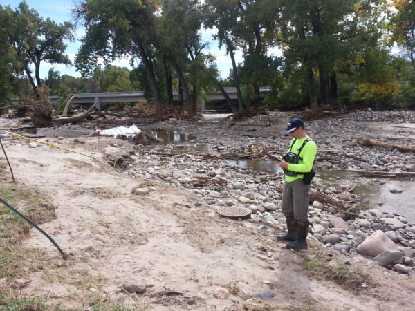
The advent of smartphones, tablets, and bluetooth GPS units has decidedly altered the way engineers, surveyors, and technicians conduct their business when out in the field. Before this new era, collecting data in the field (whether that be survey, construction plan review, construction observation, site assessments, or any other number of fieldwork tasks) involved carrying around and using a myriad of equipment and tools – notebooks, pencils, a camera, paper maps, plan sets, you name it. Then, once that data was written down by hand in a notebook and photos were taken, the fieldworkers would have to go back into the office, record that data again on their computers, and have it reviewed.
Fast forward to the life of an engineer or surveyor working in the field today. In about the past five years, engineers have started using mobile devices – including smartphones, tablets, and bluetooth GPS devices – to gain efficiency, accuracy, and an easier transfer of data, among other benefits. Instead of juggling a camera in one hand, a notebook in the other, and other “stuff” crammed into a backpack, now you can have everything in one place. And better yet, whatever data and photos are collected, it is instantly transferred to the internet cloud.
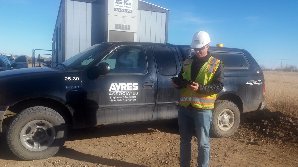
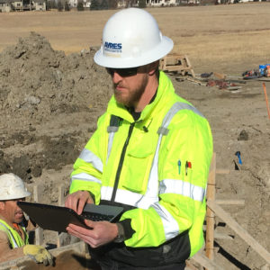 As for devices, many of our engineers use tablets to record data that they carry in rugged, waterproof cases designed for field use. Chest packs designed to carry tablets work well during long days in the field. Smart phones also are effective ways to take notes, document field conditions, and take (and store) photos. Although most smartphones have a GPS on them, we do use small GPS units with bluetooth receivers because these devices tend to generate more accurate data and maintain a constant position.
Besides the actual devices, engineers also can load a variety of apps onto their smartphones and tablets to help them do their jobs more efficiently while conducting fieldwork. For documenting field conditions and taking notes, our engineers use GeoJot, an app that allows you to take notes, add photos, and tag the photos to a GPS location. Another app engineers have been using in the field is Site Diary. In classic fieldwork, an engineer/surveyor would take written notes in the field, take photos with a camera, and then go back to the office to process all that information and have it reviewed. With this app, you can pull up a day and start recording notes, pull the weather forecast, and attach photos, among other functions. All the information is then instantly uploaded to Dropbox in the cloud. Those who are not on-site can review the field notes in real time, with everything in one place.
Other apps allow you to make custom forms to fill out on the go, such as Fulcrum. Fulcrum allows you to quickly create custom forms for field teams to use for tasks such as conducting safety inspections, equipment inventories, surveys, and reports. We also use a mapping application called Avenza PDF maps, where you can create a map in the office and then use it interactively in the field. You can create a georeferenced pdf of design plans in the office and then view the maps on-site with your location shown on the plans like in Google Maps, only with a custom background.
A big difference with using electronic mobile devices paired with these kinds of applications in the field is that data and documents are now stored in the cloud. If you drop your device and it breaks (or falls in the river), your data is safe because it already resides in the cloud. In the past, a crew working out of town would go out into the field and collect data with written notes, go back to their hotel rooms and enter in the data, and then physically mail the files on a zip drive to the office just in case something would happen to their computers in the meantime. Now backing up data is effortless, and better yet, it’s instantly accessible.
Dusty Robinson’s primary focus is on river engineering studies. Part of our water resources group, Dusty has extensive experience using GPS to support hydrographic surveying and mapping. He has experience on multiple software applications to aid in project organization, understanding, and communication. He routinely uses GIS, CADD, HEC-RAS, SMS, RMA2, FESWMS, GlobalMapper, and web-based applications to complete project objectives.


Post a comment: