Wetland Delineation: What it is and Why it Matters
 Though bogs and swamps may not conjure up images of critical natural resources, it’s hard to overstate the role played by wetlands, as they’re collectively known. Wetlands are unique ecosystems that provide numerous ecological services, including water purification, carbon sequestration, wildlife habitat, and flood control. Wetland delineation is an essential tool for identifying wetlands’ presence and helping to mitigate future developments’ adverse impacts on them.

About the Expert:
Rob Wayne is an environmental scientist with 8 years wetland experience related to delineation, mitigation and permitting. Rob has conducted over 150 wetland delineations in Wisconsin, Minnesota, and Iowa since 2016. He is an Assured Wetland Delineator through the Wisconsin Department of Natural Resources. He is also a certified Karner Blue Butterfly surveyor with experience with local, state and federal environmental permitting.
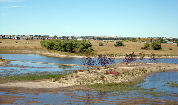
What is a Wetland?
The U.S. Army Corps of Engineers (USACE) maintains the Wetlands Delineation Manual, which provides guidelines for determining when to classify an area as a wetland. In most cases it’s not that difficult to see what areas might fall into that category:
- Under normal conditions, the land will be inundated or saturated by surface water or groundwater. (The area will usually be wet or muddy.)
- The land will support plants that are adapted to wet conditions.
- The soil will show evidence of saturation.
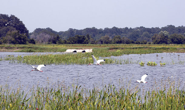
Although an individual property owner may not welcome the restrictions the classification imposes, wetlands have value – especially regarding their role in flood control.
- Wetlands act like a natural sponge, soaking up rain and snowmelt and storing the water so it can dissipate slowly, reducing the potential for flood damage downstream.
- Just one acre of wetland – less than the size of a football field – can store up to 1.5 million gallons of water.
- Wetlands allow water from storm events or snow melt to pool, reducing the volume of water running off and producing subsequent strain on roads, culverts, and other infrastructure.
- By capturing and slowing the flow of water, wetlands help protect shorelines from erosion.
When water “pauses” in a wetland, pollutants have a chance to sink and be taken up by plants, helping to keep the waters cleaner. And wetlands provide essential habitat for many species of plants, birds, and animals – ones that often cannot exist elsewhere.
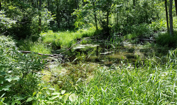
What is Wetland Delineation?
Wetland delineation is the process of identifying, characterizing, and mapping wetlands on a property. This process involves a combination of fieldwork, data analysis, and consultation with regulatory agencies. During the fieldwork, experts evaluate the site’s characteristics, including soil type, vegetation, hydrology, and topography. These characteristics can indicate the presence of wetlands. Experts use indicators of hydrology, hydric soils, and hydrophytic vegetation to identify the presence of wetlands. They then map and document the boundaries of the wetlands on the property.
 As a developer or project decision-maker, wetland delineation and its potential findings may seem intimidating. Here’s what may be top-of-mind and why you might be overthinking it:
- Complex Regulations: Regulations surrounding wetland delineation and permitting are complex and challenging to navigate. Working with a consultant specializing in regulatory compliance and environmental permitting is crucial.
- Your Limited Expertise: Wetland delineation requires specialized knowledge and expertise. Working with an experienced consultant helps mitigate potential unknowns and makes for a high level of certainty that wetland boundaries are accurate.
- Time Constraints: If you’re on a tight project schedule, delays can be costly. Understanding the importance of meeting deadlines is important, and so is leveraging the latest technology and equipment to maximize efficiency and accuracy.
- Potential for Delays and Project Interruptions: Delineations can uncover previously unknown wetland boundaries, which if not delineated could potentially lead to delays or project interruptions during permitting.
- Cost Concerns: Depending on the size of your project, wetland delineation can feel like an additional expense. However, this additional expense can save considerable amount of money and headaches if a non-delineated wetland is disturbed during your project.
Did You Know About Assured Wetland Delineators?
In Wisconsin, the Department of Natural Resources has an Assured Wetland Delineator program for highly experienced professionals who meet strict qualifications, including education, training, experience, and performance standards. What does working with an assured wetland delineator mean for a project?
- Wetland delineation reports receive automatic concurrence/approval when submitted to the WDNR. An assured wetland delineator provides clients high confidence in the accuracy of their reports, as well as expedited project schedules. With non-assured wetland delineators, the required review can take the WDNR up to 60 growing-season days to complete.
- Additionally, non-assured report submissions that require DNR review cost $300 per 20 acres. So, eliminating that review can also have a significant impact on cost.
Why Does Wetland Delineation Matter? Mitigation.
Wetlands are now considered an asset, and the U.S. Environmental Protection Agency (EPA) policy is to avoid or minimize adverse impacts to wetlands when possible. But sometimes there’s no other way to complete a needed project. One example might be reconstructing a roadway to make it safer. If wetlands are adjacent to the existing road, they are bound to be affected by the work.
The EPA calls for “compensatory mitigation” in such situations to replace the loss of wetlands in the watershed. Compensatory mitigation could mean several things:
- Restoration: Re-establish or rehabilitate a compromised historic wetland.
- Establishment: Create a new wetland.
- Enhancement: Improve existing wetlands to make them more effective and healthier.
- Preservation: Use legal and physical mechanisms to protect or enhance an existing ecosystem.
The USACE or an approved state authority determines the appropriate type and amount of compensatory mitigation required when a project negatively affects a wetland. Project owners can restore, establish, enhance, or preserve wetlands to compensate for the affected site. In doing so, they assume responsibility for the wetlands’ ecological success and long-term protection.
 Or project owners can purchase credits from a mitigation bank. A wetland mitigation bank is a wetland that has been restored, established, enhanced, or preserved and is then set aside to compensate for future loss of wetlands. With the correct permitting, a project owner can purchase “credits” from the mitigation bank to compensate for the loss of or damage to the negatively affected wetland. With this approach, the project owner does not assume responsibility for the long-term health of the wetland.
It’s not impossible to build in or develop an area that contains wetlands, but the permitting process can get complicated – and for good reason. Regulations are in place because those bogs, marshes, fens, and swamps play a vital role in flood control and maintaining water quality, and we’re losing thousands and thousands of acres yearly, according to the EPA.
Ayres’ experts work with clients to preserve and protect wetlands and mitigate unavoidable damage or encroachment. For more information, contact environmental scientist Rob Wayne, WDNR Assured Wetland Delineator.


Comments are closed.