Innovations in Transportation Infrastructure
 Transportation and traffic engineers are constantly in pursuit of practical, effective solutions. Here’s a sampling of some recent innovations.
1. Back-in angle parking’s advantages vs. standard parking
- Studies have shown it’s safer and easier than parallel and front-in angle parking.
- Visibility is increased for the driver when leaving the parking space.
- The risk of a driver clipping bike and vehicle traffic while opening their door is eliminated.
There has been a bit of a learning curve (maybe a learning angle?) for new drivers attempting to tackle back-in angle parking for the first time. The familiarity with, and expectation of, front-in angle parking has had some motorists “driving British” – using the opposite side of the road so they can more comfortably pull forward into parking spots.
However, studies have shown back-in angle parking is easier than parallel parking and safer than front-in angle parking, plus it provides better visibility when leaving a parking spot. Head to our Back-In Angle Parking post for more information on the new, safer parking trend.
2. You’ve heard of bike lanes, but what are bike boxes?
- A bike box encompasses on-pavement markings that allow bicyclists to queue up in front of traffic at a red light, giving them more visibility.
- Studies have shown that both drivers and bicyclists carry a favorable view of bike boxes and that their presence reduces conflicts and increases safety through yielding and priority.
If you’ve encountered a sea of high-visibility green markings at an intersection, chances are you’ve found a bike box. The green pavement marking provides a place in front of vehicles where bicyclists can wait for a red light to turn green.
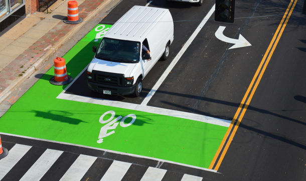
This brightly colored box gives bicyclists visibility and priority in moving through the intersection. That helps keep bikers safe and traffic moving. Learn more about bike boxes and how to use them as a biker and what do to when you’re the motorist.
3. What the heck are HAWK signals?
HAWK signals are also known as high-intensity activated crosswalk beacons. Here are the four steps involved in using a HAWK signal:
- The pedestrian pushes an activation button, and the signals facing traffic start flashing yellow.
- The lights turn solid yellow, and drivers should stop if it’s safe to do so.
- The lights turn solid red, and all traffic is required to stop, giving pedestrians the opportunity to cross.
- Drivers can proceed with caution when the lights begin to flash red.
According to a Federal Highway Administration (FHWA) crosswalk study, total crashes fell by 29% and pedestrian crashes were reduced by 69% after HAWKS were installed.
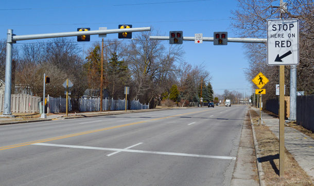
Everything evolves, including crosswalks, and HAWK beacons are one of the latest innovations. Typically installed at crosswalks with a painted pedestrian pathway and signage in place, these beacons add flashing traffic signals on both sides of the road, alerting traffic to the presence of pedestrians whenever the crossing button is pushed. For this reason, HAWK signals work well on busy roads when traditional signage and pavement markings may not be enough to capture driver attention. Our HAWK signal post has more information on this crosswalk innovation and a video of it in use.
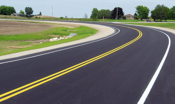
4. Road diets: How many lanes should a road have?
- Road diets result in less lane-crossing and often involve implementing a dedicated two-way-left-turn lane (TWTL), which has been proved to reduce the number of crashes.
- The decrease in lane count means there’s more room for other uses like parking, sidewalks, landscaping, and bike lanes.
Sometimes reducing the number of lanes on a road is the key to helping traffic flow more smoothly. A common conversion engineers face is bringing a four-lane roadway down to a three-lane one, providing a travel lane in each direction with a middle lane from which to make left turns.
Why is this better? A standard roadway is 48 feet wide, and each lane is using a share of the limited space. By removing a lane, there is extra real estate available for sidewalks, bike lanes, and parking. Studies have also shown that, due to less exposure and a change in traffic expectation, drivers tend to end up in fewer accidents on the three-lane road than on a four-lane one. Our comprehensive road diet post has a detailed explanation.
5. Wondering what a woonerf is?
The woonerf, which is Dutch for “living street,” is a street that is shared by cars, trucks, bikes, and people without the need for traffic lights, painted lines, and similar traffic control devices. Through increased awareness, patience, and a little bit less of the all too popular individualism, woonerfs manage to get along just fine and are viewed as a social space.
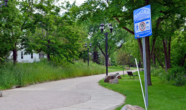
The late Dutch engineer Hans Monderman developed the shared-space concept of urban design. He carried out a dichotomous view of transportation infrastructure, envisioning a “traffic world” and a “social world.” Highways and freeways will always carry traffic, and drivers in these spaces will always be individual. But cities and villages are a social place, and drivers are guests. The same feels true for woonerfs: They are a social space, and drivers are just visiting, with the ultimate responsibility for taking their time and remaining aware. Click here for a deeper dive into woonerfs and their role in our communities.
Interested in some examples of the unique ways we’re impacting communities? Check our transportation and traffic projects. And if you’d like to learn more about trends in transportation infrastructure or the services we provide, contact our Transportation experts.


Post a comment: