Remote Catamaran Retrieves Data and Keeps Surveyors Safe
 Conditions are sometimes too dangerous for water resources engineers to get up close and personal to collect hydrographic survey data at bridges.
When scouting bridges in 2012, Ayres Associates’ staff decided one bridge – U.S. Highway 8 over the St. Croix River in Polk County, Wisconsin – was impassable by jet boat and not navigable even by inflatable raft. To survey this bridge foundation, our staff decided to try the next best thing – an unmanned catamaran.
While the bridge’s piers are socketed into rock, the river bed elevations must be monitored to determine if the river is undermining the piers or causing excessive scour. The trick was accomplishing this monitoring safely.
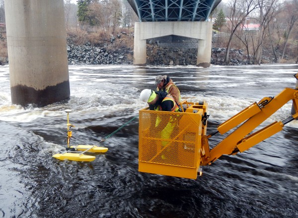
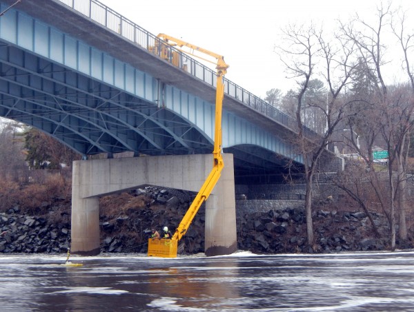
Pete Haug, a water resources engineer, used the catamaran recently to remotely collect St. Croix River bed soundings amid the turbulence under the U.S. Highway 8 bridge. The well-known Dalles of the St. Croix River and Interstate State Park are downstream from the bridge, where the entire river squeezes through tight rapids and steep canyons. During this survey, the nearby kayak rental at Wild Mountain recreation area classified the rapids below the bridge as Class IV, requiring advanced maneuvers and posing a high risk to swimmers.
After closing one lane of this high-traffic bridge connecting Wisconsin and Minnesota, an under-bridge inspection vehicle (aka “snooper”) lowered Pete to the water level, where he controlled the catamaran. Data was collected using sounding equipment and was stored in the onboard memory until the catamaran could be retrieved. This system kept Pete safe while allowing the catamaran to survey waters that were flowing more than 7 feet per second and creating 2-foot-high waves. See how the process looked in this video.
For more information about our hydrographic survey services, please contact our River Engineering + Water Resources professionals.


Post a comment: