HEC-RAS Software: How Math Mitigates Flooding
 By John Hunt, Senior Hydraulic Engineer
When it comes to 1-dimensional open-channel hydraulic analysis, the Hydrologic Engineering Center’s (HEC) software program HEC-RAS is considered the gold standard. The program is a vital tool water resources engineers use for floodplain mapping and river hydraulics. Simply stated, HEC-RAS software is used to model water flowing through rivers and compute water surface profiles, including the analysis of where water will encroach in a flood event. It is the most commonly used tool for river hydraulics in the United States.
The program was first introduced in the mid-1990s as an update to the HEC-2 program, which became outdated with the advent of Windows for personal computers. HEC-RAS is superior to its predecessor in that it is graphically driven, user friendly, and provides improved calculations with higher accuracy. The program now is on its fifth version, with 2-dimensional modeling added in the most recent iteration.
Common Uses of HEC-RAS
Commonly, hydraulic engineers, including those at Ayres Associates, use HEC-RAS for a multitude of functions, including:
- Performing bridge hydraulic analysis to assist with bridge design. These results help determine how long a bridge needs to be, how high the bridge deck should be designed to provide adequate flood protection, and how deep to design bridge foundations to withstand scour (erosion around piers).
- Conducting floodplain analysis, such as assessing what impact new or existing infrastructure has on the floodplain.
- Analyzing river hydraulics for the design of streambank protection.
- Assessing flood mitigation methods.
- Performing flood mapping studies for the Federal Emergency Management Agency (FEMA).
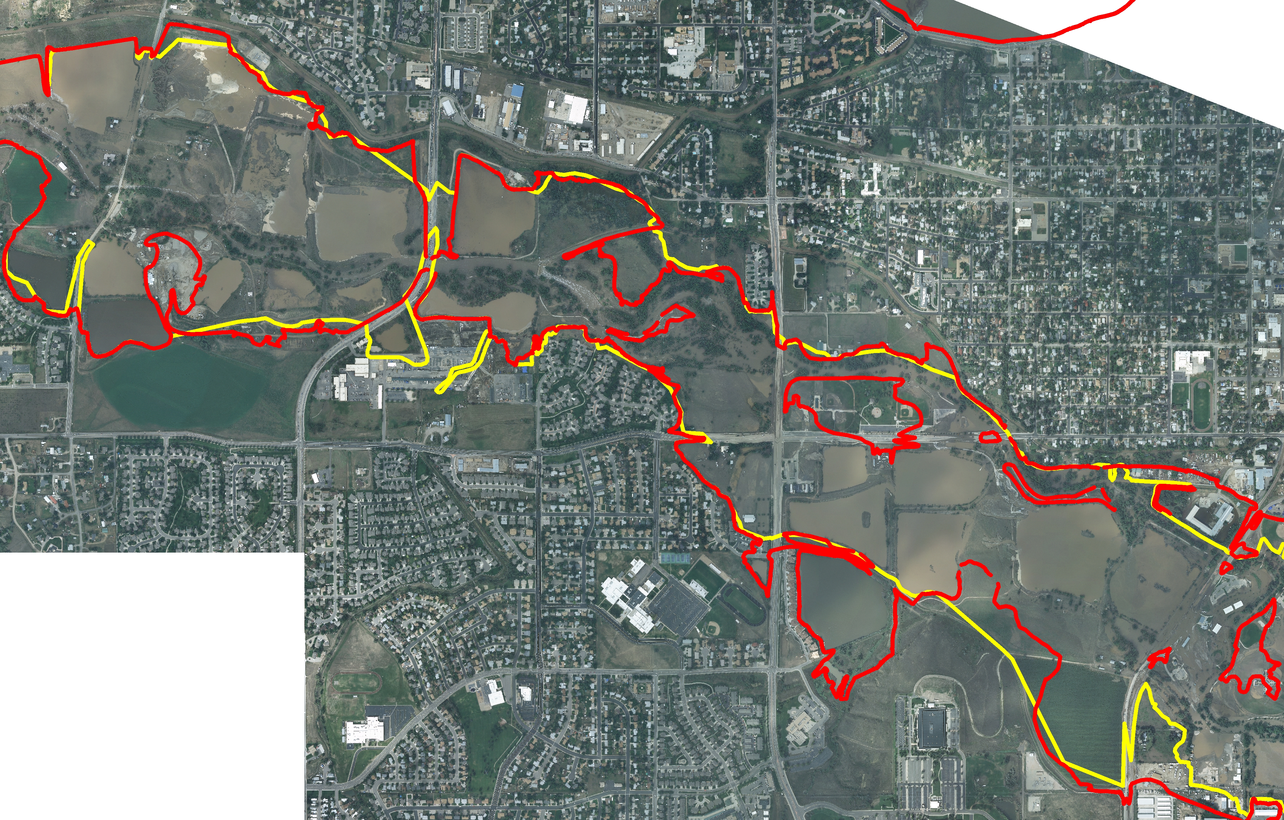
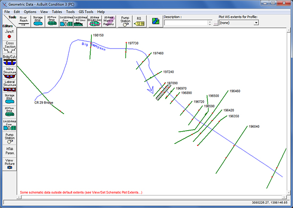
When using HEC-RAS, engineers gather cross-sectional ground data of rivers and floodplains developed from land surveys and aerial mapping to put into the model. Additional data includes the roughness of the terrain in question (such as whether water will be flowing through trees versus grass). Finally, the model analyzes data on flow rates for varying flood severity levels, gathered from existing studies and other analyses.
The result of all this data and the calculations by the program is a water surface profile, which indicates the water surface elevation at points along the river or stream for a given flood. The model also allows the engineer to estimate the flow depth, velocity, and shear stress values, along with other important variables necessary for scour calculations. The program allows engineers to compare existing conditions to proposed conditions once design changes are made, whether that be changes to a bridge structure or infrastructure on a streambank, for example.
HEC-RAS Training Necessary for Accurate Results
On a cautionary note, HEC-RAS is a robust program that will run even if the data is poor. Therefore, it requires careful data entry and review and validation of the results to avoid inaccuracy in the water surface profile. Inaccuracies that may seem minor can lead to significant problems in flood analysis or infrastructure design. For example, small inaccuracies in the water surface elevation upstream of the bridge can lead to important deficiencies in the design of a new bridge. Professionals using the program should seek formal training to develop the skills necessary to get accurate results.
Many providers offer training on HEC-RAS, one being the National Highway Institute (NHI). Engineers at Ayres Associates have been teaching the NHI’s course, “One-Dimensional Modeling of River Encroachments with HEC-RAS,” to state departments of transportation and others since 2002. The three-day class teaches the basic skills needed to develop and run a 1-dimensional HEC-RAS model, including the analysis of bridges and culverts.
John Hunt, PE, is manager of the river engineering group in Ayres Associates’ Fort Collins, Colorado, office. He teaches the NHI HEC-RAS course nationwide and has contributed to the HEC-RAS Hydraulic Reference Manual.
Comments
Nice Information.


Post a comment: