Surveyors Stepping Up to International Foot
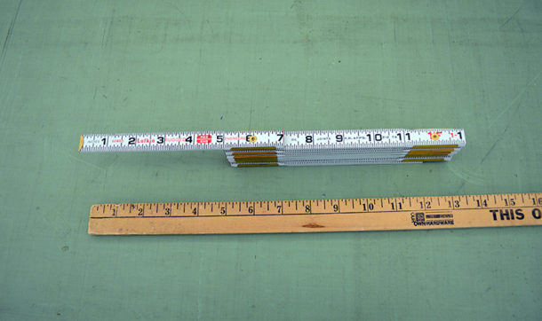
How long is a foot? Well, that depends on who’s doing the measuring, what state they are doing the measuring in, and what measuring “stick” they are using.
Land surveyors in most U.S. states use the U.S. survey foot. The rest of the world, including some U.S. states, uses what’s known as the international foot, which is just a touch shorter than the survey foot. The difference is so small – about an eighth of an inch when measuring a mile – that it doesn’t affect most distances reported in land surveys, but when you measure the United States from coast to coast, our country is about 28 feet longer using the international foot.
Most of the problems begin when you convert from meters to feet and those values are used in conjunction with a rectangular coordinate system that defines locations of objects by assigning values on a two-axis grid system, such as “northings” and “eastings.” Some of these coordinate systems use values that are in the millions of feet because they cover entire states or large portions of a state. Converting these large values between feet and meters using the wrong version of a foot introduces errors that can be measured in tens of feet.
The National Oceanic and Atmospheric Administration (NOAA) created a video explaining how the miniscule difference can make a big difference when working with state plane coordinates. Surveyors using those coordinates need to know which foot measurement is used in the state where they are working.
These errors, measured in feet, turn into errors measured in dollars when they involve large construction projects that can end up in court. There are reports for major problems for a high-speed rail project, a bridge spanning two states that use the different versions of a foot, and even a building that had to be redesigned to remain clear of an airport approach path.
To add some historical background to the issue, the United States Coast and Geodetic Survey Office of Weights and Measures abandoned the British Imperial Yard and defined the “foot” as 1,200/3,937 meter (or 0.3048006 meter = 1 foot) in 1893, thereby tying the foot to the meter. In 1933, a new rounded off definition of the “foot” was adopted by other organizations as 1 foot = 0.3048 meter (exactly).
Finally, in 1959, the same year Ayres started in business, the entire country adopted the 1933 version of the foot with one exception. The exception was for data derived from “geodetic surveys” within the United States. The surveying community continued to use the 1893 definition of a “foot,” which was, from then on, known as the “U.S. survey foot.” That “pardon” has lasted 60 years.
 NOAA and the National Institute of Standards and Technology announced this fall that all states will need to use the international foot beginning in 2022. The hope is that uniformity across the nation will start to minimize the confusion, and users will document their work more closely. The timing of this change coincides with even bigger changes involving the horizontal and vertical datums that all these measurements are expressed in. That is a whole different “shtick.”
The survey, aerial mapping, engineering, and architectural fields should all be happier when everyone is using the same measuring stick in 2022.
For more information about changes to the horizontal and vertical datums, check out:
Task Force Positions Geospatial Community for Proposed 2022 Datum Changes
Comments
Great job Dick! That truly defines the history and “family” of the basis of FOOT and how a supposedly simple thing becomes so complicated. Thank you!!


Post a comment: