Breaking Down the Zipper Merge
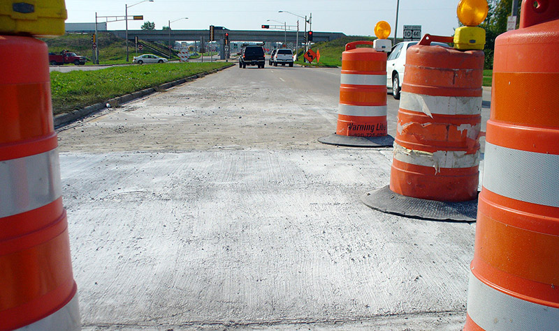
By Nathan Silberhorn, PE Here’s the scenario: signs warn that a lane of traffic will close soon, and two lanes of vehicles will be narrowed to one. Some drivers merge early and get to the through lane as fast as possible, then wait for traffic to advance. Others don’t seem to have a problem zooming… Read More »
Tags: Freeway Interchanges, Lane Closure, Merging, Traffic, Traffic Backup, Transportation Engineering, Zipper Merge
UAS Oblique Imagery Helps in Design and Monitoring of Projects
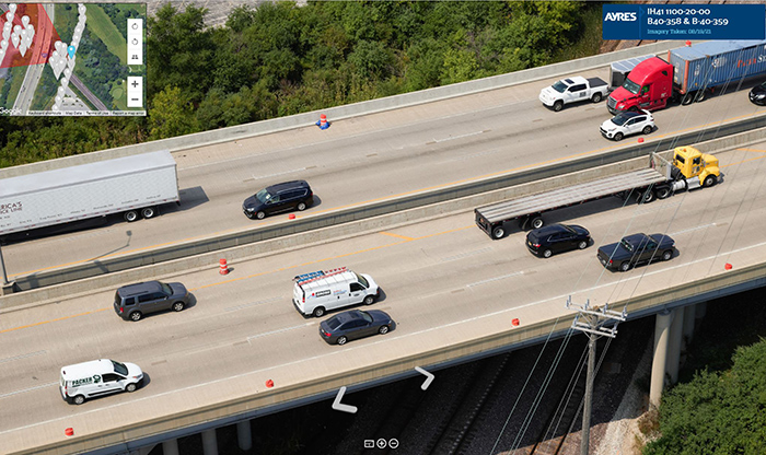
By Paul Crocker Drones have revolutionized managers’ ability to collect updated imagery for project design and construction monitoring. While the standard nadir (straight down) imagery and lidar is commonly used for topographic mapping and planimetrics, oblique imagery is another valuable option to build a complete picture of the project site. About the Expert: Paul Crocker,… Read More »
Tags: 360-degree Panoramic Images, 3D Models, Drones, Metric Camera, Nadir Imagery, Orthomosaic, Phase One Camera, Planimetrics, Topographic Mapping, UAS, UAS Oblique Imagery, Unmanned Aerial Systems
Taking Notice: Is that a Bridge or a Culvert?
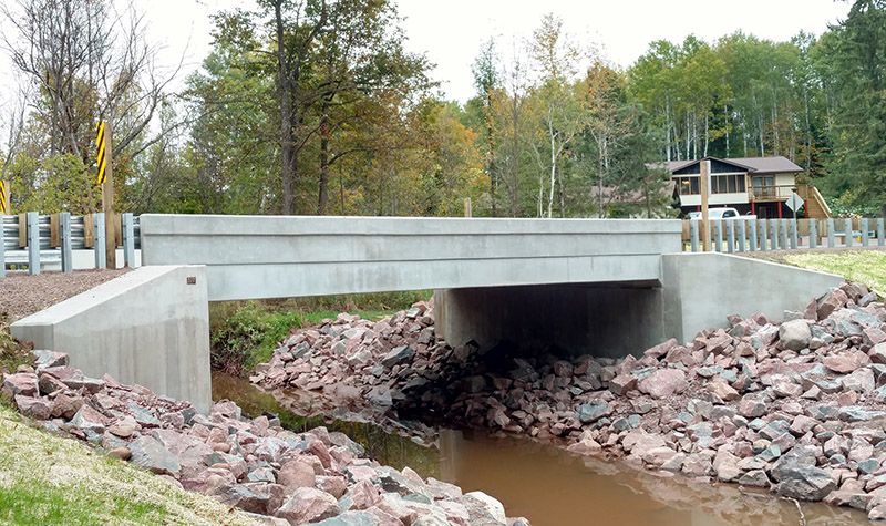
Drivers intent on getting from Point A to Point B probably don’t notice how many times their vehicles travel over culverts and bridges along the route. And that’s good: unless the structures are designed to capture attention and add to the scenery, bridges and culverts are purely functional, allowing traffic to pass over ravines, bodies of water, roadways, railroad… Read More »
Tags: Arch Culvert, Box Culvert, Bridge, Bridge Design, Culvert, Culvert Design, Federal Highway Administration, Pipe Culvert, Pipe-arch culvert


