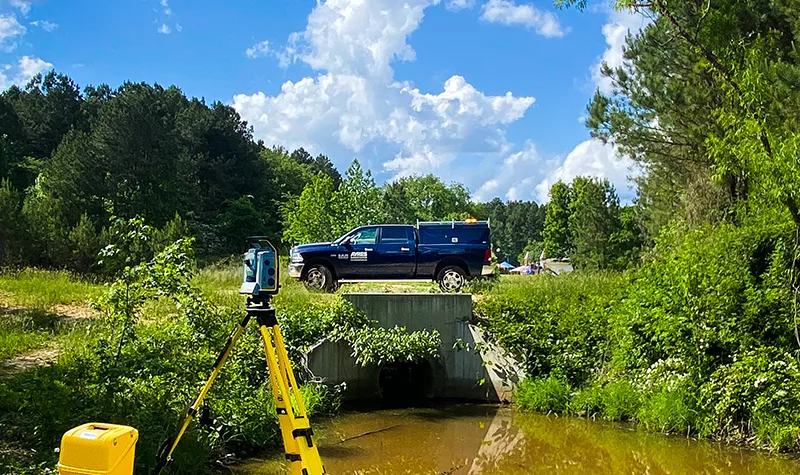
How UAS Lidar and Imagery Support Transmission Line Projects
By Niklas Anderson, GISP, Geospatial Project Manager,and Paul Crocker, UAS Program Manager High-quality geospatial data enhances the planning and design of transmission line projects. While we don’t perform transmission line design ourselves, Ayres’ in-house unmanned aerial systems (UAS) fleet and sensor technology allow our pilots and data compilation technicians to provide the detailed, accurate datasets… Read More »
Tags: Ayres, Geospatial
We’ve Been Named a Top Workplace – and Here’s Why

By Carie Sommer Earlier this spring, we were excited to announce that our company made USA TODAY’s 2025 Top Workplaces list. This designation is a significant milestone for us, and it’s all thanks to the wonderful culture we’ve built together. The award symbolizes our commitment to creating an atmosphere where employees feel valued, engaged, and… Read More »
Tags: Ayres
What is an ALTA Survey?
ALTA, otherwise known as the American Land Title Association, is a national development aimed at improving the skills and knowledge of providers of real property. Members of ALTA are responsible for reviewing, researching, and insuring land titles to protect their owners. Ayres stands to benefit from the association utilizing ALTA surveys. In this blog post,… Read More »


