Sleigh Bells Ring, Are You Tracking?
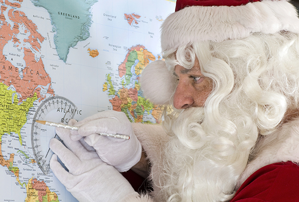 For the past 50 years, kids have been able to keep tabs on Santa during his delivery route thanks to the North American Aerospace Defense Command (NORAD) team. While this is undoubtedly excellent and very useful information, we wondered how exactly Santa knows where to stop once he’s loaded up that sleigh and checked his list twice.
We turned to Jason Krueger, geospatial expert from our Madison office and likely North Pole consultant (though, wishing to remain on the aforementioned Nice list, he could not confirm this, citing client privacy and proprietary concerns).
“In the most basic sense, the NORAD Santa tracking application uses customized, web-based geographic information systems (GIS) in conjunction with global positioning systems (GPS) to geo-locate Santa Claus throughout the earth,” Jason says, brushing a pile of wooden toys marked with “Account Paid: SC” into his filing cabinet. “Although NORAD uses a wide range of aerial, ground-based, and space-based sensors to track Santa’s progress, the data actually needed for his complex delivery process is derived from far more sophisticated technology.”
When pressed about this technology, he taps a candy cane thoughtfully against his chair and says, “The details of the platform employed by Santa and his team of geospatial elves is highly classified, but it is likely to use high-resolution, multi-spectral digital aerial imagery, aerial lidar (light detection and ranging), and possibly mobile lidar. On-board GPS and an inertial measurement unit (IMU) are also used to create accurate flight line trajectories along the way,” he adds with a wink.
Which seems to mean that however many Sarahs and Michaels there are, Santa never gets confused about which place to go because each girl and boy has their own location signature – as long as they’re in bed.
Jason does have a word of caution for children contemplating any last-minute naughtiness with the idea that it won’t be noticed. “All of this information is managed by Santa’s technical team in an enterprise license of GIS software where the geodatabases are updated on-the-fly,” he says, kicking a jingle bell under his desk. “Santa’s established flight plan can be altered, should any misbehavior render this necessary.” Looking off into the distance, as if recalling a long-ago event, Jason tears up a bit.
He then brushes what appears to be reindeer fur off his shoulder and notes that it’s not just Santa making the magic happen. “All this also requires a substantial amount of ground control and ground-truthing performed by qualified professional elf-surveyors, too,” he says. Our interview is interrupted by a sudden clatter arising out on the lawn. He springs from his chair with an apology and says he must take this client call, then hurries outside to a waiting sleigh.
“Do you have any other comments for our readers?” I shout out after him.
He calls back: “Happy Christmas to all, from all of us at Ayres!”
Post a comment: