Game On! Pokémon Go and Real-World Applications
 As people scour the countryside trying to catch Pokémon, engineers and architects and scientists are working from top to bottom and side to side – calculating X Y coordinates and using sophisticated 3D analysis tools – to perform specialized and highly technical geographic work not unlike the GPS-driven augmented reality game.
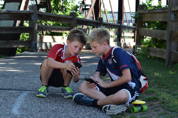
Pokémon Go, the wildly popular location-based mobile game released earlier this month, loosely parallels several scientific disciplines, such as aerial mapping. Pokémon Go players use smartphones to catch virtual creations found in real-world places, using maps and geographic data to locate Pokémon and landmarks known as “PokeStops.” (Happen to be reading this in the Sunshine State? Here’s some help to find Pokémon Go gyms and PokeStops in Tampa.) Similarly, aerial mappers analyze geographic features and develop applications that allow everything from estimating volumes at landfill sites to supporting transportation design efforts.
Gamers do ground-level visualization in Pokémon Go, and aerial mappers perform visualization using imagery collected from planes and drones. The augmented reality displayed in the game is similar to spatial modeling, in which geospatial technicians collect data remotely, process a real-world data model, and, at times, superimpose features.
Geospatial technologies are used to analyze events such as the devastating flooding in Ashland County, Wisconsin. Roads were washed away in the July 11 storms. Pre- and post-flood surface images, with flood waters superimposed, provide a picture of the damaged roads and washed-away material – a form of augmented reality, albeit much more scientific and quantitative.
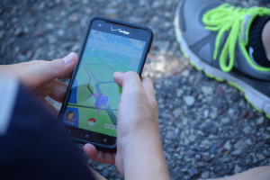 Pokémon Go players use components built into their smartphones – GPS, gyroscope, and camera – in ways beyond their original intent. The cameras overlay Pokémon images into gamers’ real-world environment. Players show up on a map based on their GPS location and see the Pokémon characters superimposed on the same map. Readings from the phone’s gyroscope indicate the device’s orientation, allowing it to know which direction players are looking and helping them capture Pokémon creatures when pointed the right way. Individually, none of the sensors would allow for this to be done, but putting the camera, GPS, and gyroscope together in this way provides this new functionality.
Geospatial technicians also repurpose technologies and use information in new ways. The use of spatially integrated video illustrates one example. GPS-enabled cameras mounted to a vehicle turn into a valuable mapping tool by capturing georeferenced imagery and providing street-level information for a variety of applications, including developing maps designating roads suitable for hauling particular loads.
Technology is constantly evolving. Pokémon Go offers a new era in gaming, and what’s next is anyone’s guess (although the aerial mappers and surveyors at Ayres Associates have their theories). Contact Michael Seidel or Jason Krueger to discuss these theories or to learn more about the field of mapping and GIS.
Want to read about other ways augmented reality is used in other technical fields? Architects and others also use 3D graphics and realistic fly-through animation to help clients and the public visualize the end result of work-in-progress projects.
And of course, be cautious in the world of Pokémon.
Post a comment: